
Buc-ee’s Lafayette: Aerial Construction Progress & Photo Documentation
Independent aerial photographic documentation tracking site grading, building pad foundation piers, and public infrastructure improvements at 3400 Louisiana Avenue.
Verified Project Specifications
Independent Aerial Photo Documentation • November 8, 2026 Flight
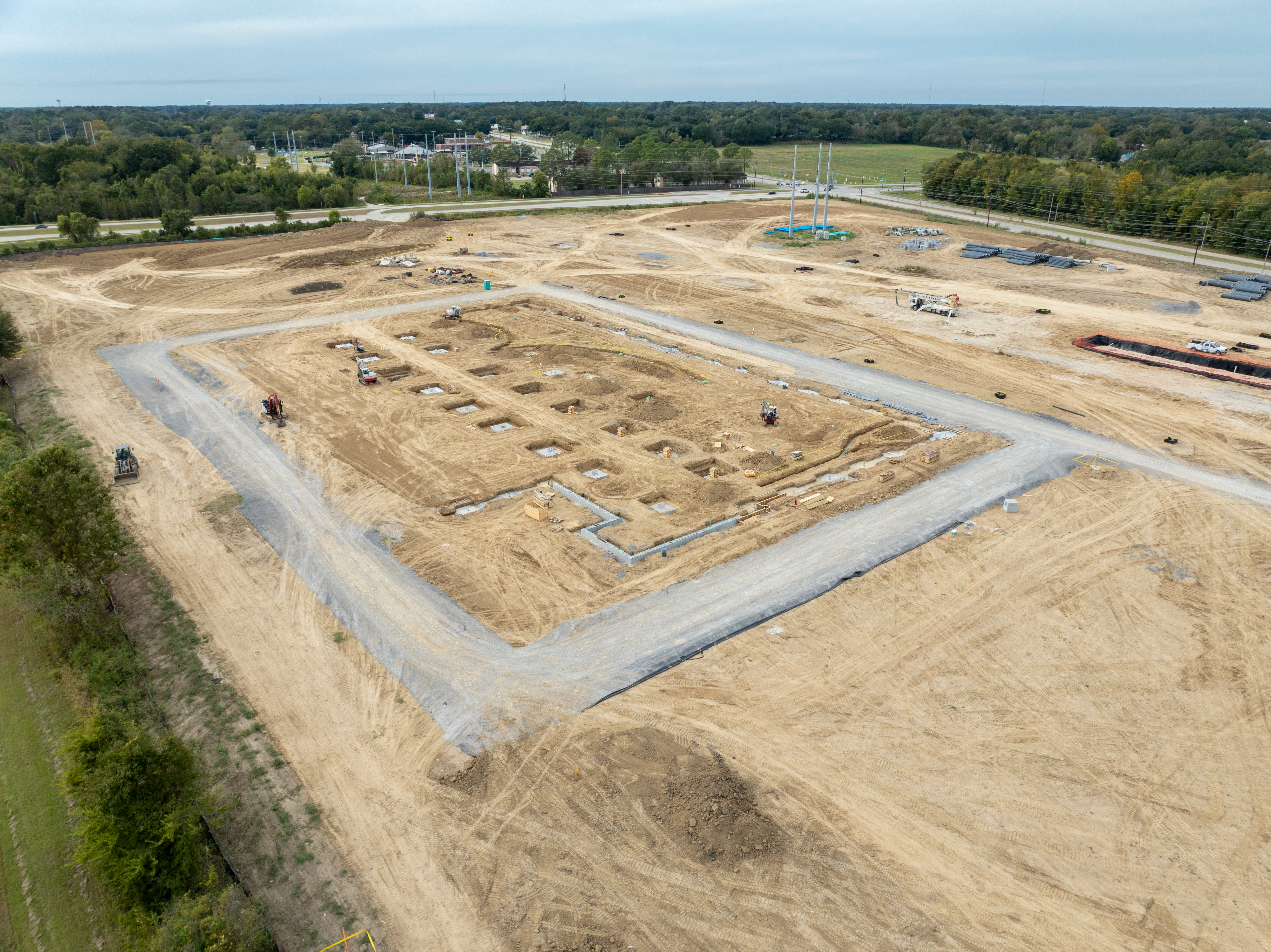
74,000 Sq. Ft. Store Footprint & Sub-Structure
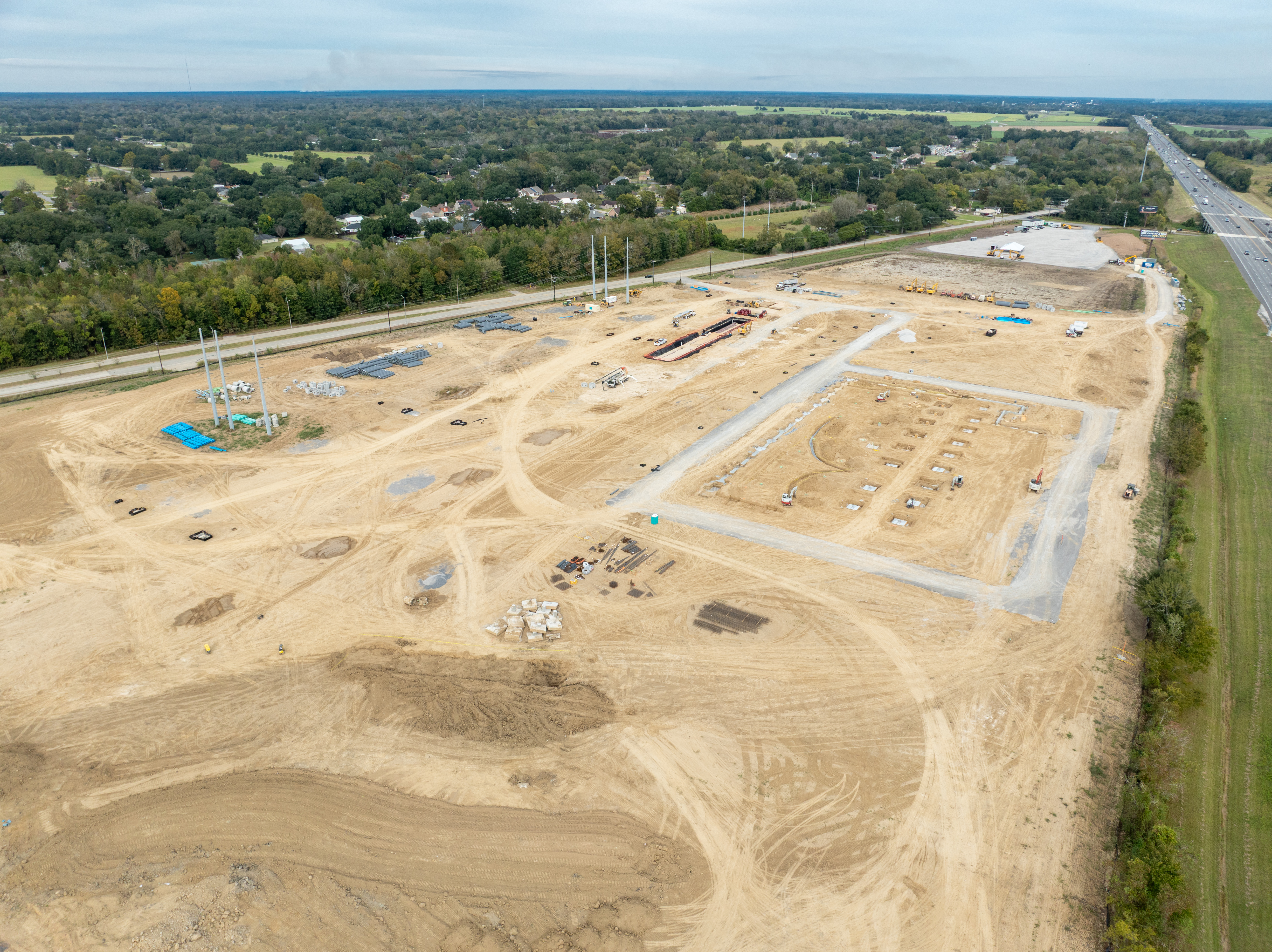
- Perimeter Grade Beams: Formed and excavated trench lines define the exterior foundation perimeter walls of the 74,000 sq. ft. building footprint.
- Poured Concrete Column Piers: Reinforced concrete column footings with vertical rebar tie dowels poured in an engineered structural grid across the pad interior.
- Fuel Vault Excavation: Deep excavation and trench box shoring positioned north of the building footprint for underground fuel storage systems.
- Permit Authority: Commercial vertical building permit issued August 11, 2026 by Lafayette Consolidated Government.
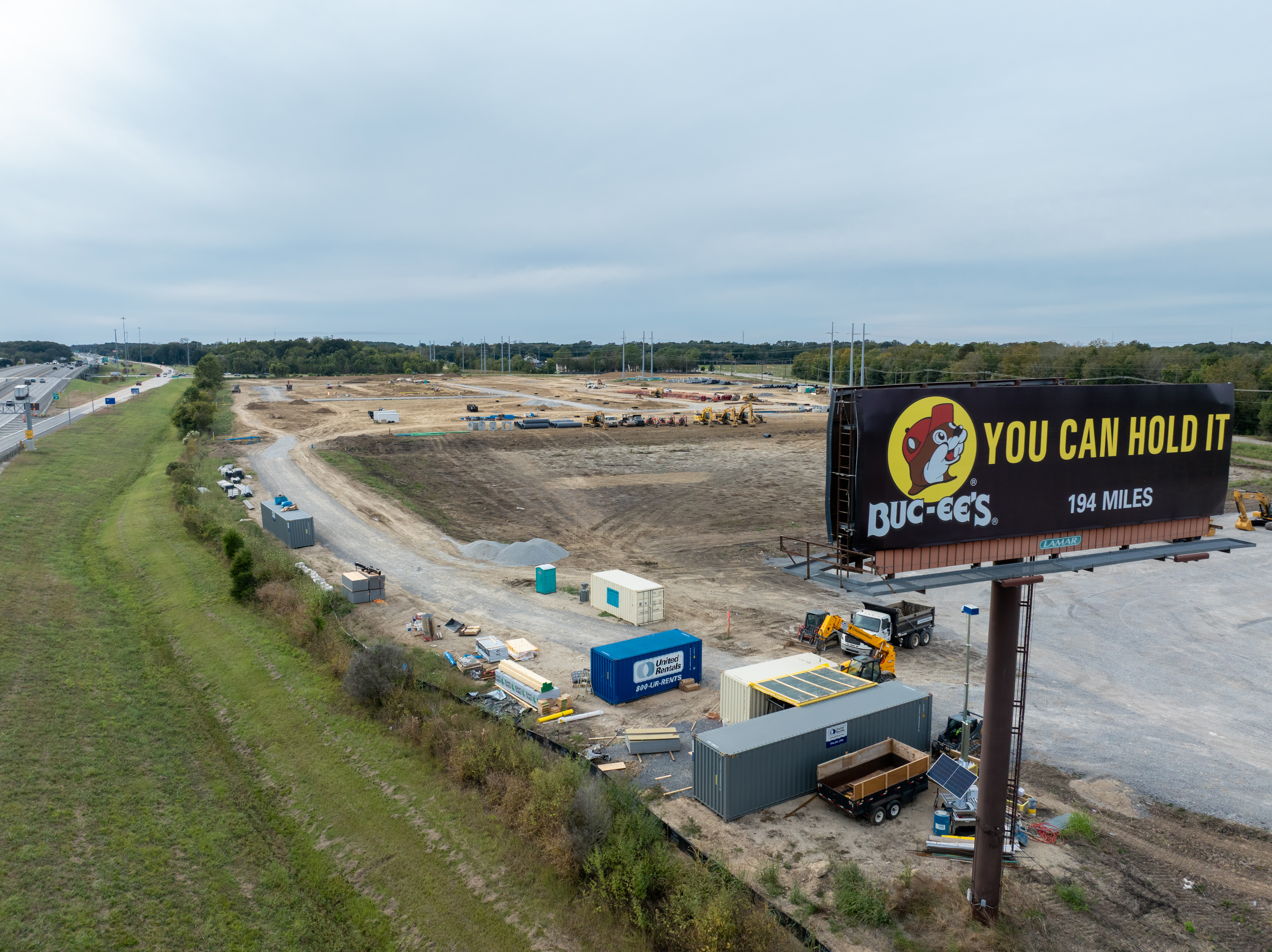
Southern Boundary Logistics & Haul Access
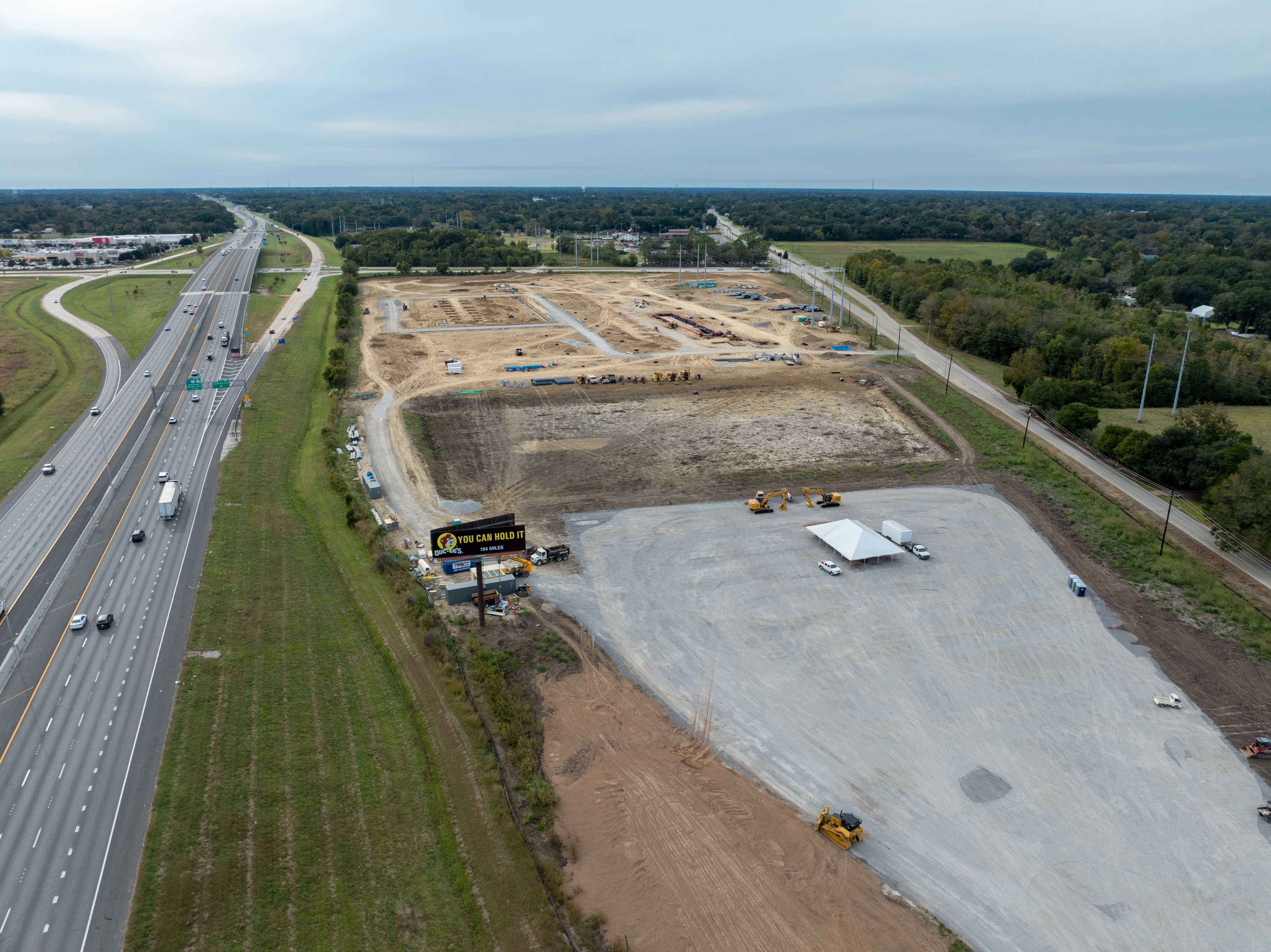
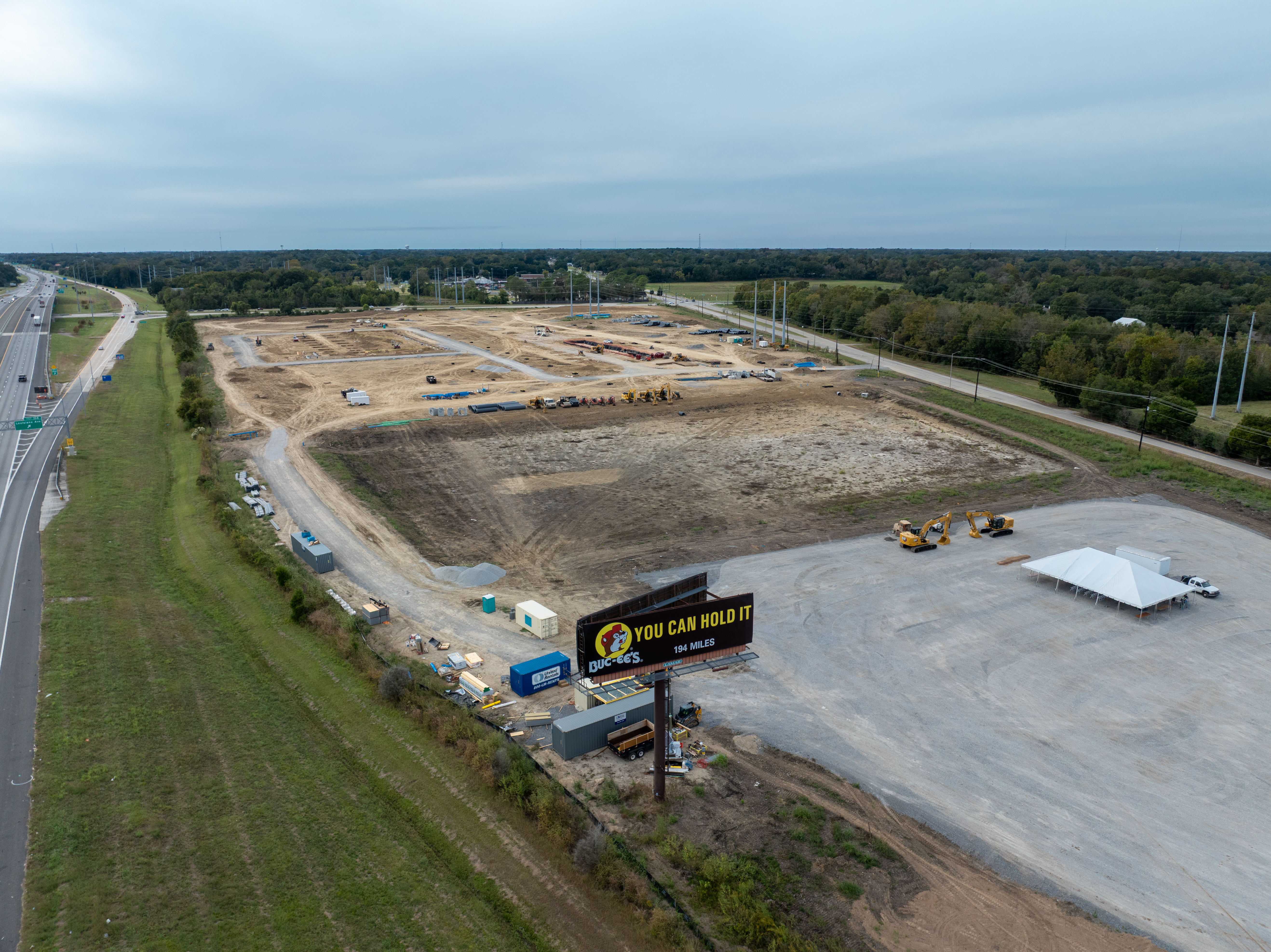
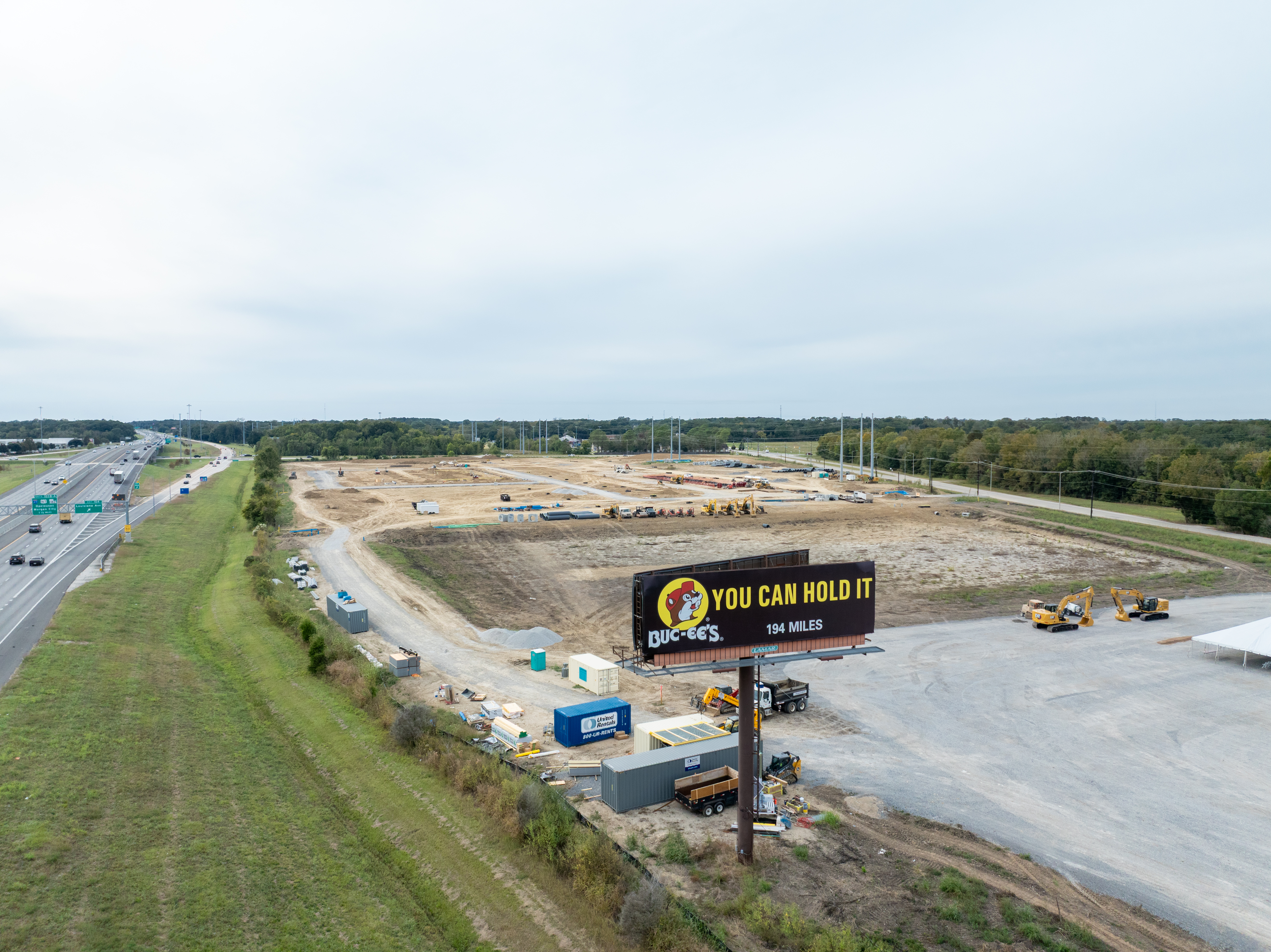
- Contractor Yard: Field office trailers, secure tool storage containers, and utility fleet staged along the southern parcel perimeter.
- Aggregate Haul Route: Compacted crushed stone haul roads connecting Louisiana Avenue to internal staging areas.
- Site Landmark: Existing Buc-ee's outdoor billboard overlooking the primary access corridor.
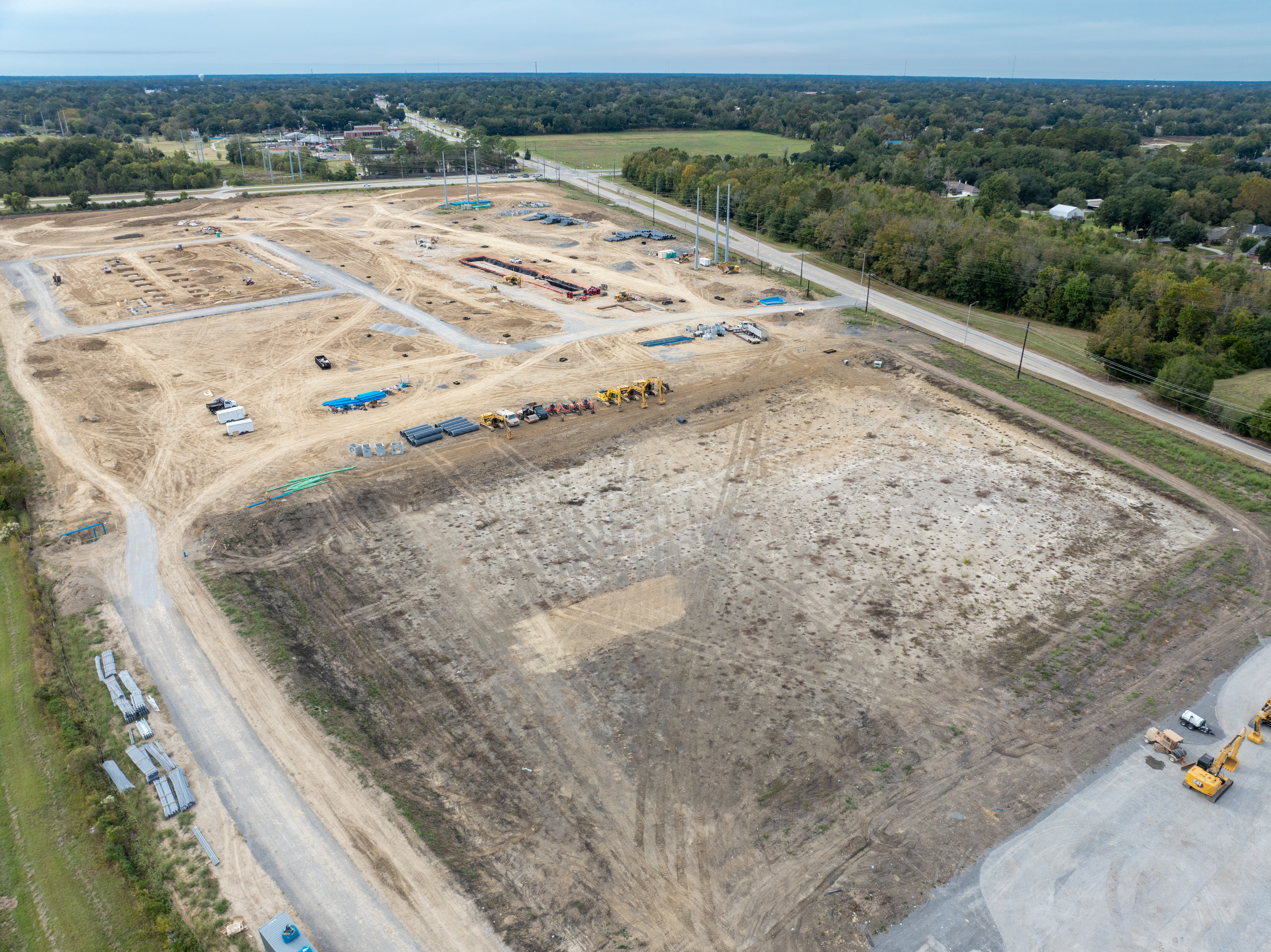
Heavy Equipment Operations & Site Drainage Basin
- Machinery Fleet: Hydraulic excavators, track bulldozers, and vibratory soil compactors operating on site.
- Retention Basin Excavation: Cut-and-fill grading shaping engineered regional stormwater retention ponds along the parcel perimeter.
- Soil Sub-Base: Graded sub-base prepared for ongoing aggregate placement and stabilization.
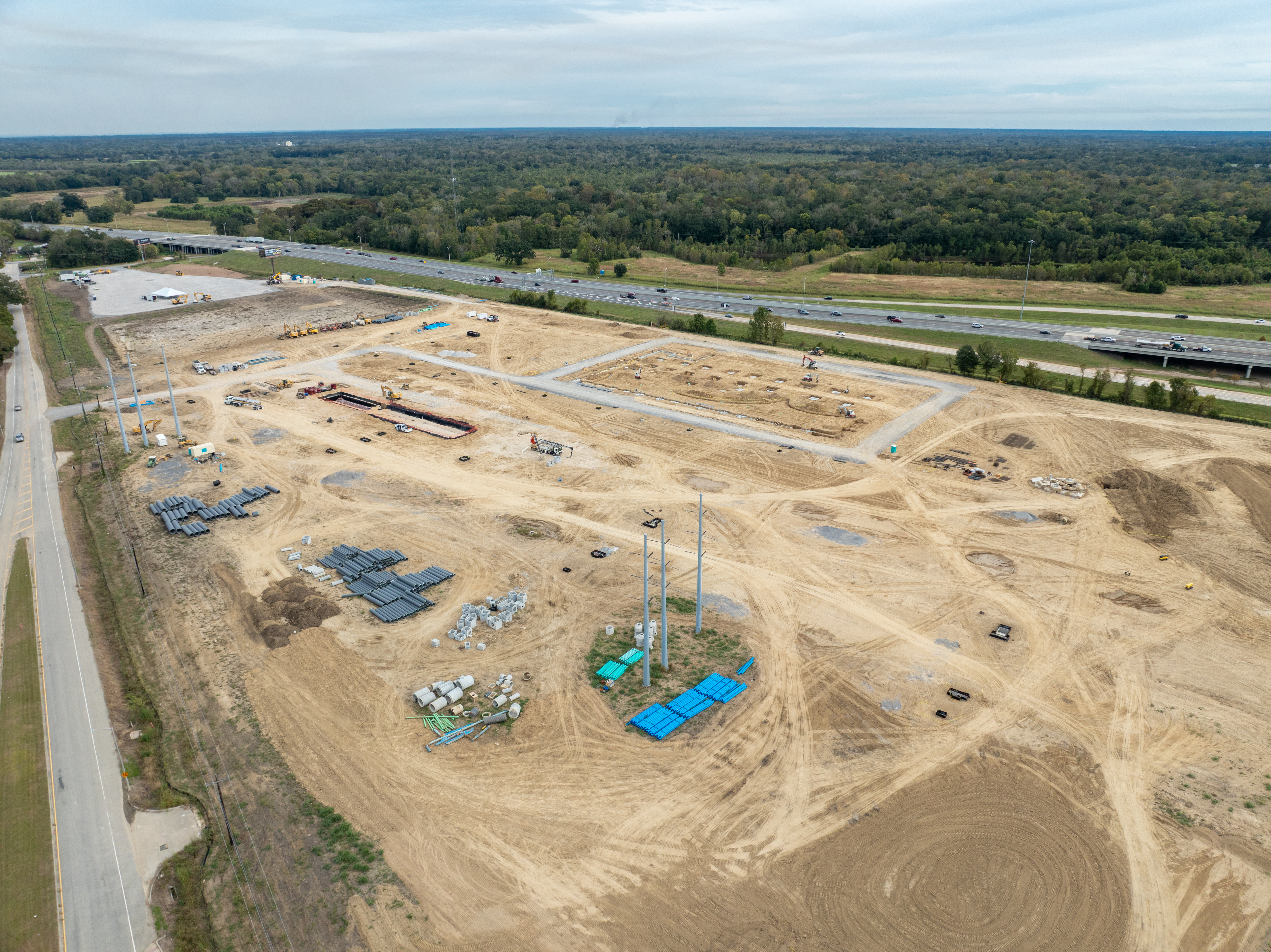
Utility Materials Staging along East Pont des Mouton Road
- Stormwater Culverts: Large-diameter corrugated polyethylene drainage pipe stockpiles staged for installation.
- Precast Drainage Structures: Precast concrete catch basins, drop inlets, and junction boxes on-site.
- Municipal Scope: Materials support the $12.5M off-site public road and utility improvements funded under Lafayette City Ordinance CO-168-2024.
Exit 103 Interchange Proximity & Arterial Access
- Interchange Connectivity: Direct alignment with Louisiana Avenue and the Interstate 10 Exit 103 overpass structure.
- Access Points: Planned traffic routing connecting interstate ramps, Louisiana Avenue, and East Pont des Mouton Road.
Verified Project Milestones & Public Records
Economic District Formation & Land Acquisition
Lafayette Parish and City Councils enact Joint Ordinance JO-022-2024 and City Ordinance CO-168-2024 establishing the Mile Marker 103 Economic Development District (Subdistrict 1), authorizing a 2% sales tax increment to fund $12.5 million in public road and utility infrastructure. Buc-ee's acquires the 42-acre Castille property via Scout Real Estate.
Public Record: LCG Ordinances JO-022-2024 & CO-168-2024Site Clearing, Drainage Engineering & Aggregate Sub-Base
Parcel clearing and mass grading undertaken. Heavy crushed limestone aggregate imported and compacted across the building pad and circulation areas following engineering plan approvals with Kimley-Horn and Louisiana DOTD.
Civil Engineering PhaseCommercial Vertical Building Permit Issued
Lafayette Consolidated Government Permitting Division issues official commercial vertical building permit for 3400 Louisiana Avenue, authorizing foundation slab construction and structural framing.
Public Record: LCG Commercial Permit RecordsPre-Groundbreaking Aerial Documentation Flight
Charles Braun Photography conducts independent aerial photographic flight documenting pre-groundbreaking baseline conditions: 74,000 sq. ft. building pad column footings, grade beam excavations, utility staging, and event marquee tent.
Independent Documentation: Charles Braun PhotographyOfficial Ceremonial Groundbreaking
Buc-ee's, Ltd. and Lafayette civic officials conduct the official on-site groundbreaking ceremony at 3400 Louisiana Avenue at 11:00 AM CST.
Public Event: Buc-ee's, Ltd. Official NoticeProjected Commercial Completion
Target grand opening window announced by Buc-ee's, Ltd. following structural steel erection, canopy construction, off-site road widening, and store fit-out.
Public Record: Buc-ee's, Ltd. Press ReleasePhotographic Documentation Catalog • All Recorded Views
Public Records & Reference Sources
- Lafayette Consolidated Government (LCG): Joint Ordinance No. JO-022-2024 and City Ordinance No. CO-168-2024 (creation of Mile Marker 103 Economic Development District Subdistrict 1 and 2% infrastructure tax increment).
- LCG Permitting Division: Commercial vertical building permit issued August 11, 2026 for 3400 Louisiana Avenue.
- Lafayette Economic Development Authority (LEDA): Project capital valuation ($82M), infrastructure allocation ($12.5M), and workforce modeling (200+ jobs).
- Buc-ee’s, Ltd. Corporate Communications: Press release (October 27, 2026) announcing official groundbreaking date and store specifications.
- Scout Real Estate Co.: Property representation records for the 42-acre Castille tract.
Independent Documentation & Photographic Disclosure: This visual construction progress tracker and report is an independent documentation project conducted by Charles Braun Photography. Charles Braun Photography is an independent commercial remote pilot service and is not affiliated with, contracted by, commissioned by, or hired by Buc-ee’s, Ltd., Buc-ee’s Lafayette, LLC, Kimley-Horn, general contractors, or any municipal entities. All imagery is captured independently under commercial remote pilot flight regulations for public interest documentation and construction progress monitoring.